


Table of contents
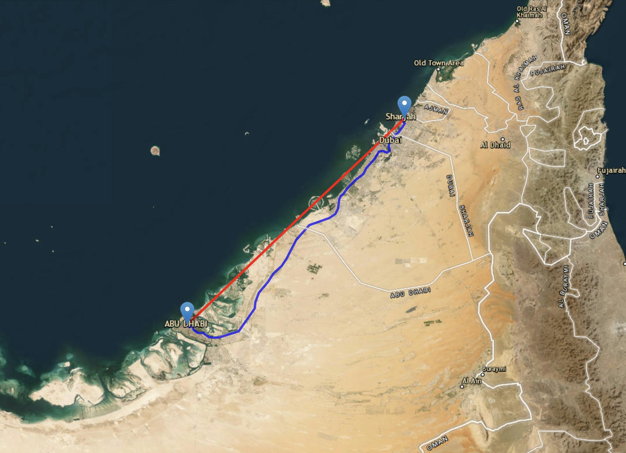
- find the distance between two places
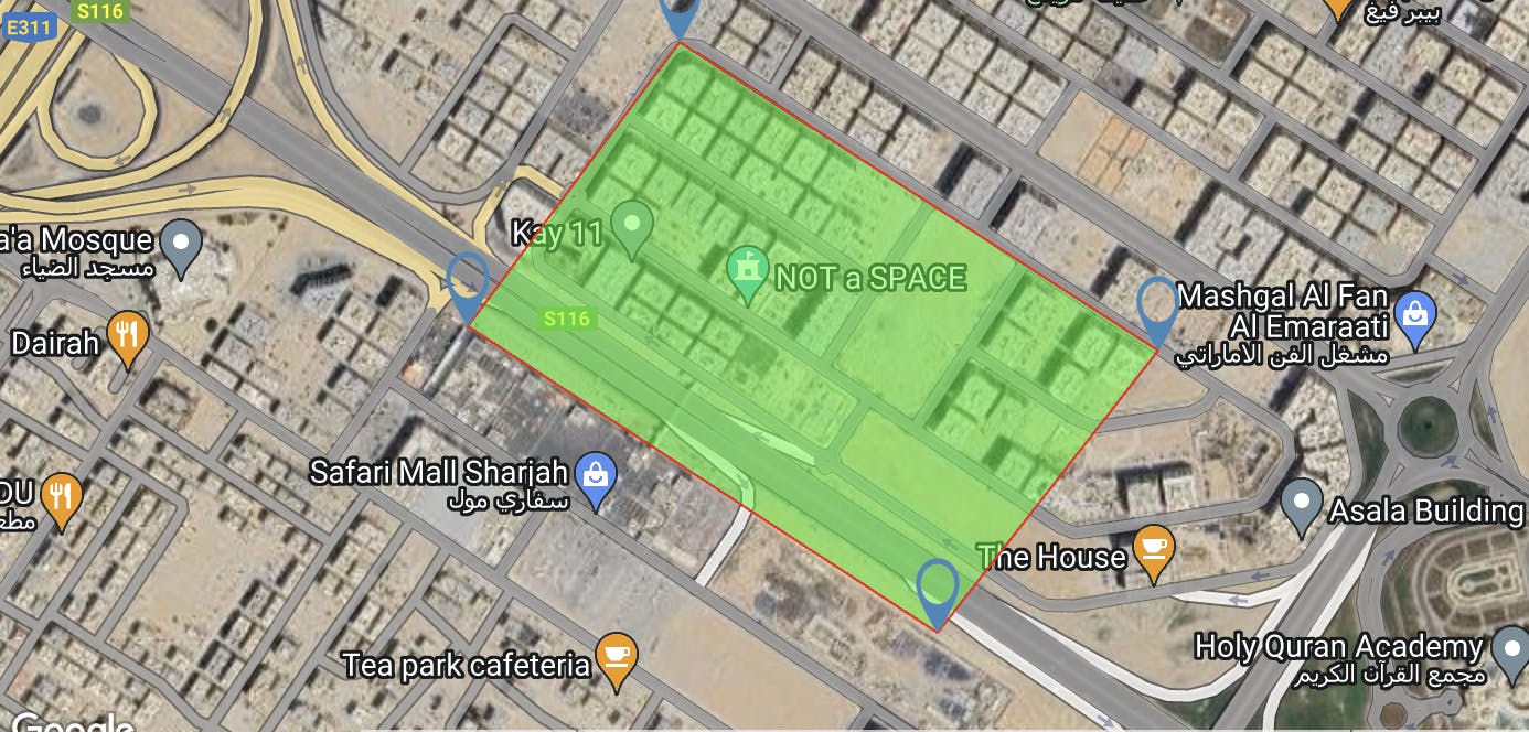
- defined polyline on a map
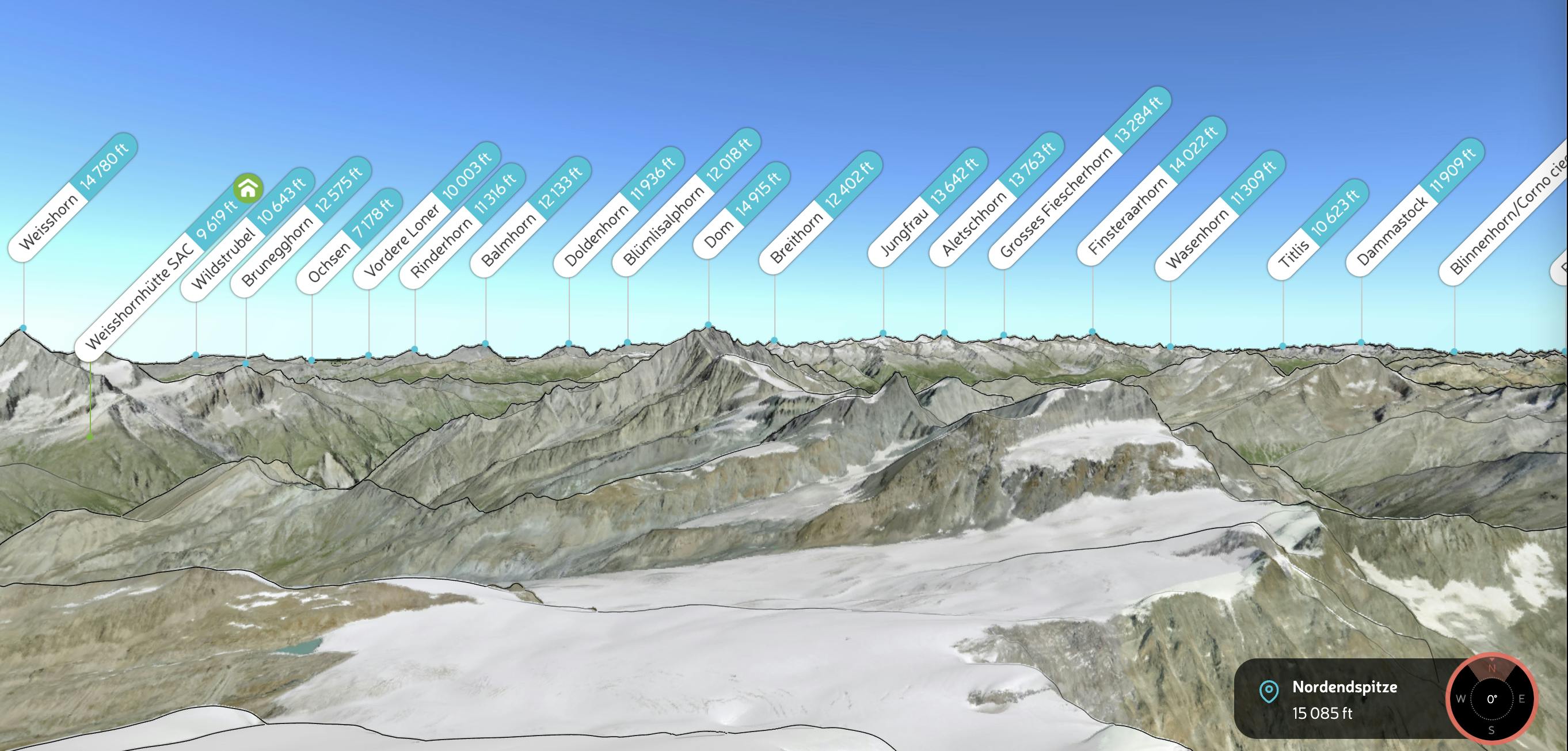
- state-of-the-art 3D maps and mountain
- Map Compare shows you different maps
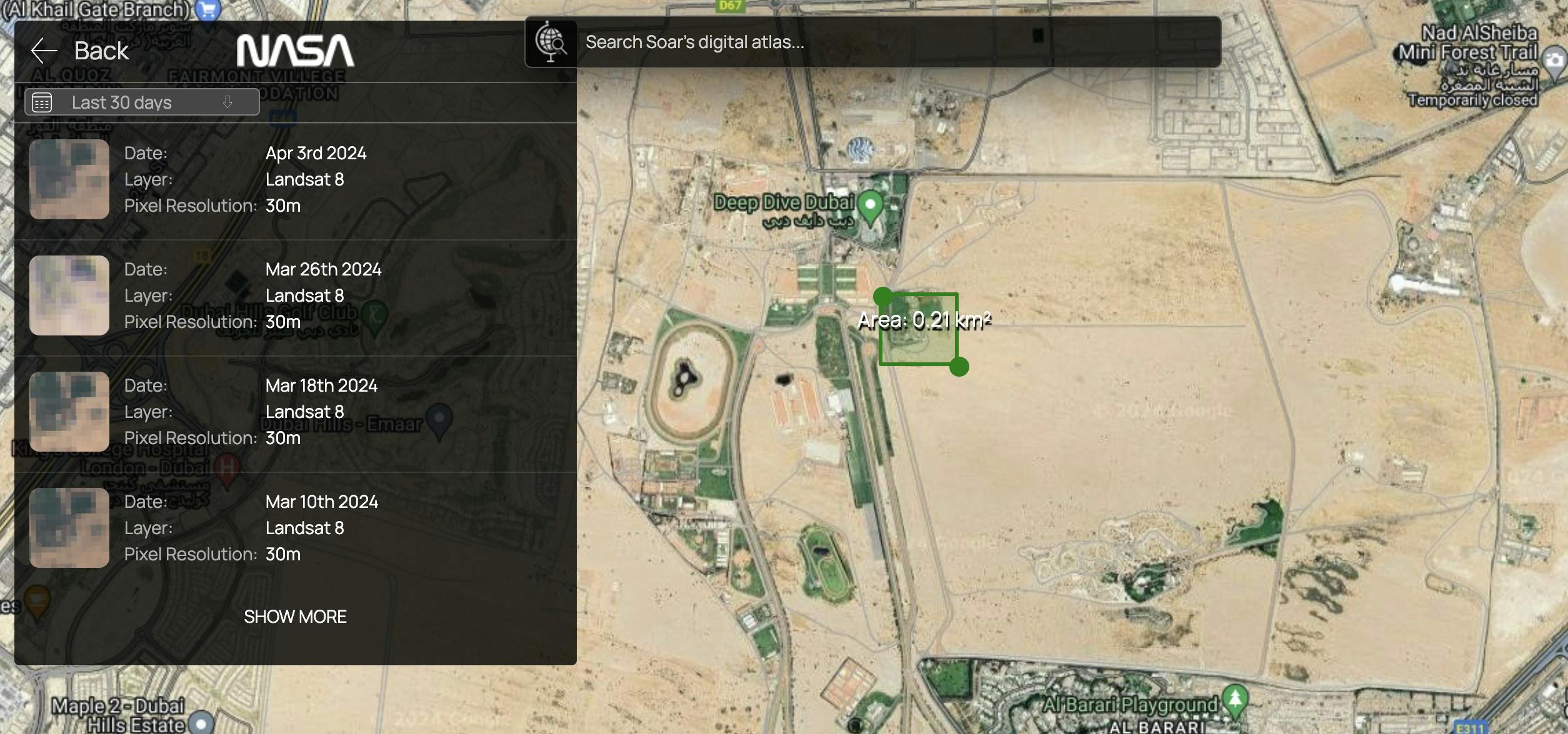
- Get Json of Specific Location
- The world's maps and images
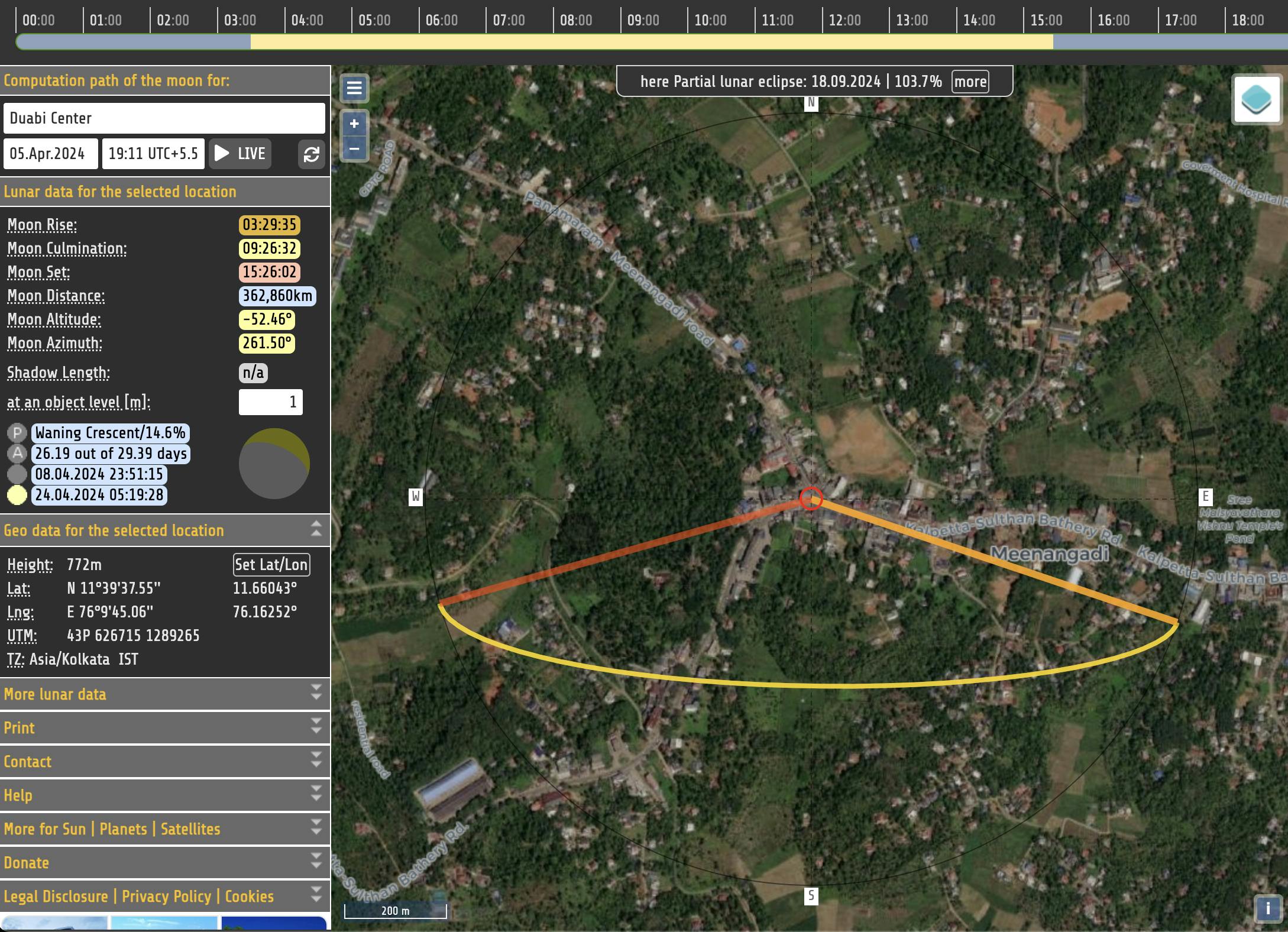
- Computation path of the moon
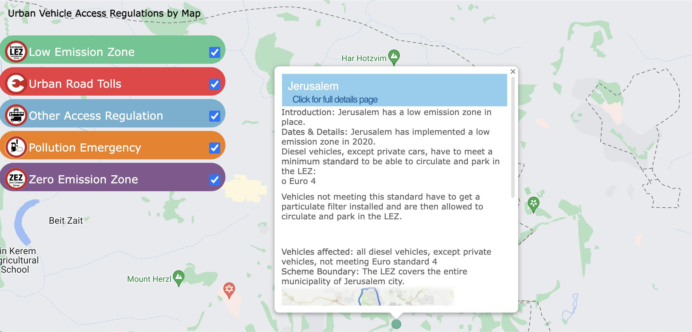
- Urban Vehicle Access Regulations by Map
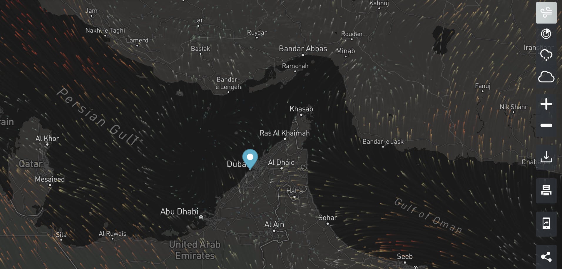
- Wind Directions
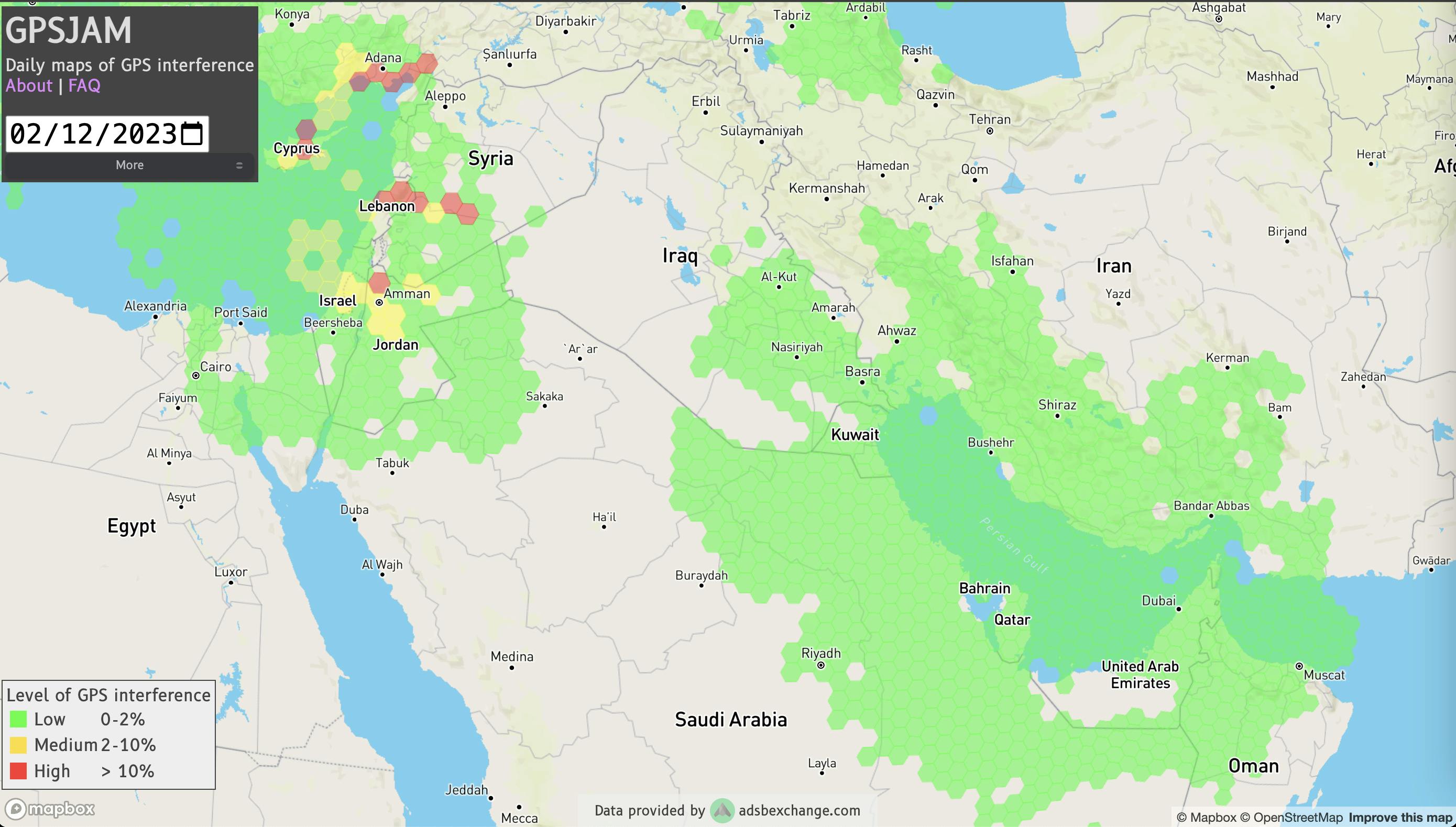
- Daily maps of GPS interference
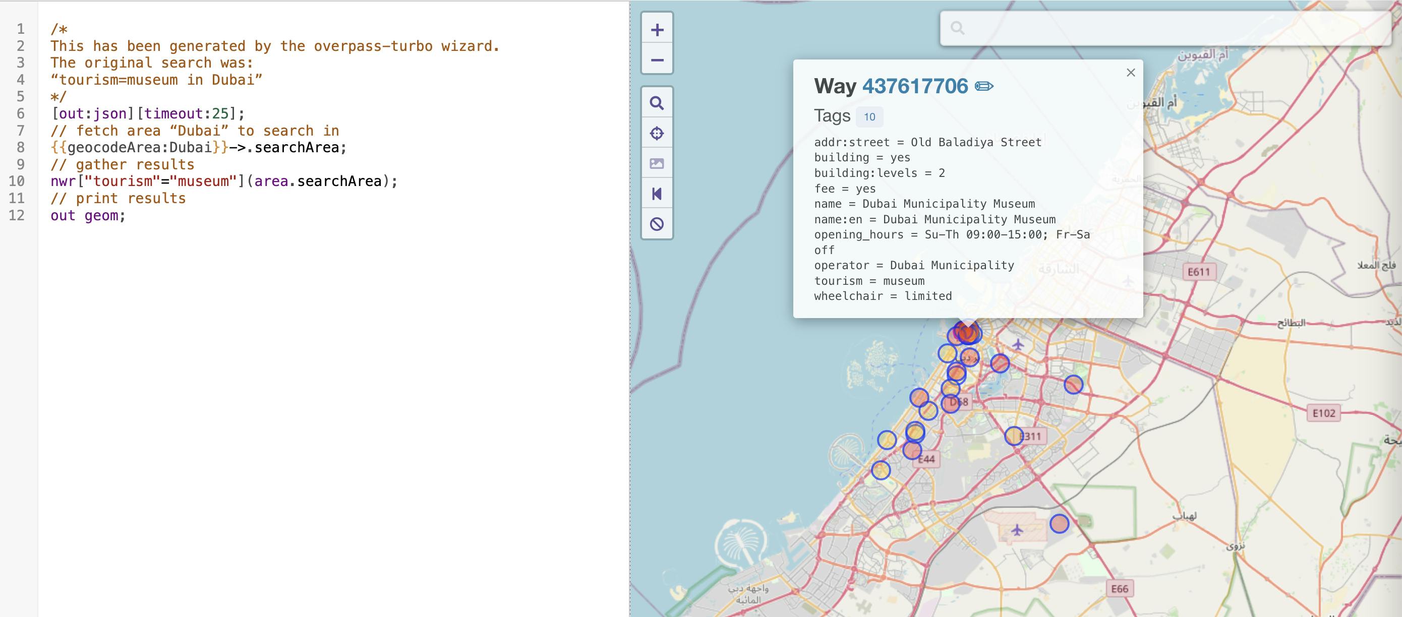
- Query Map
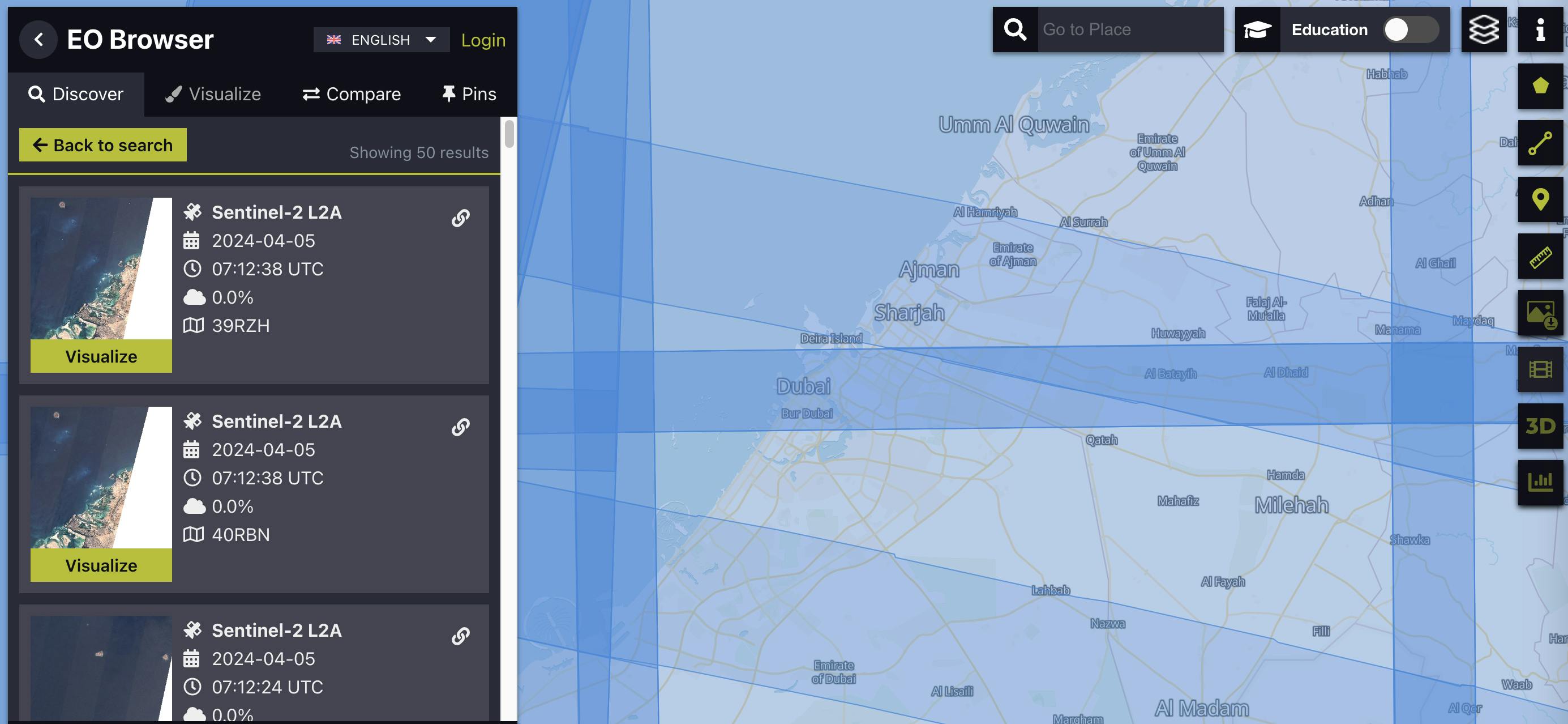
- EO Browser
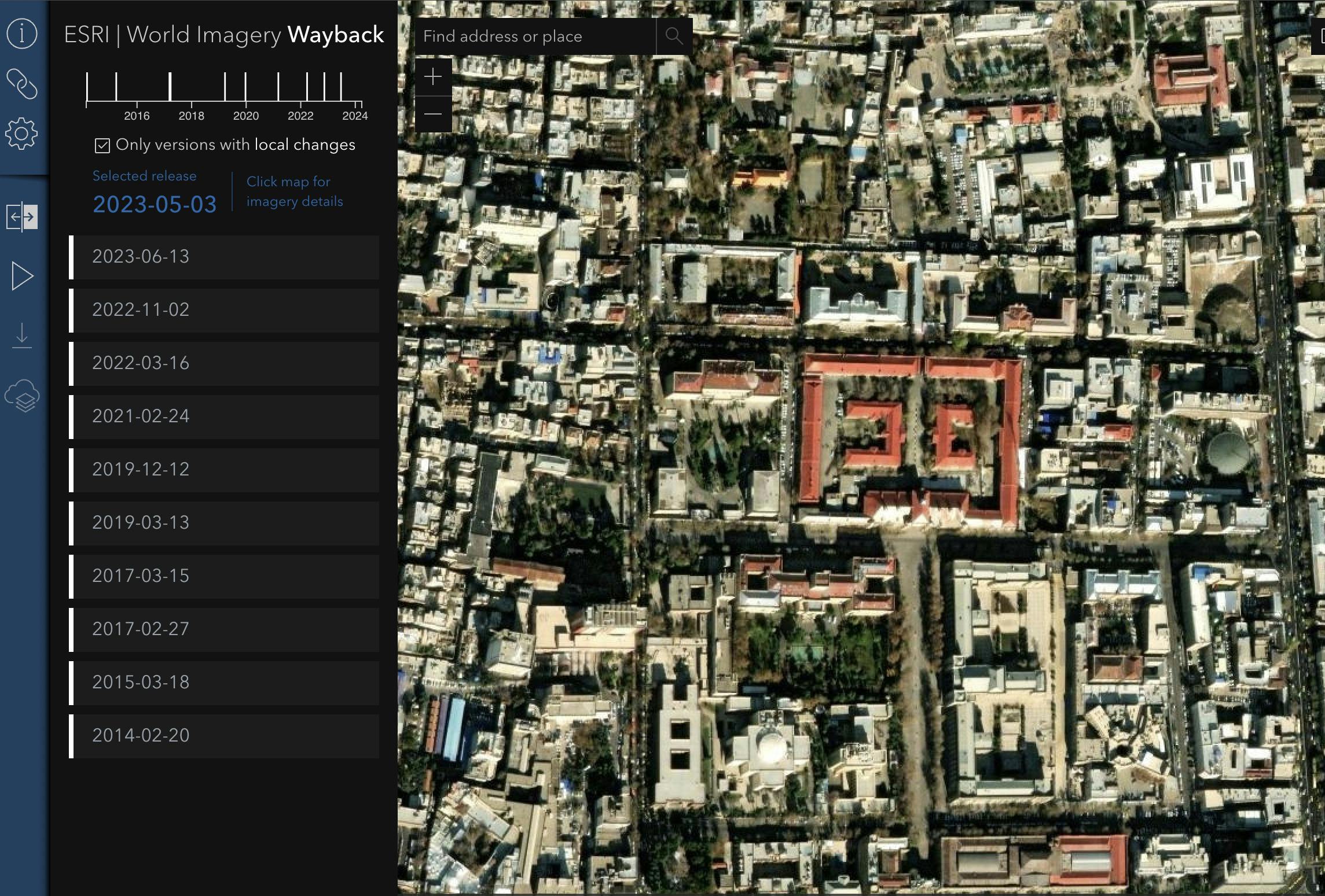
- ESRI | World Imagery Wayback
- Interactive Map Solutions
- Simulate sun shadows for any time and place on Earth
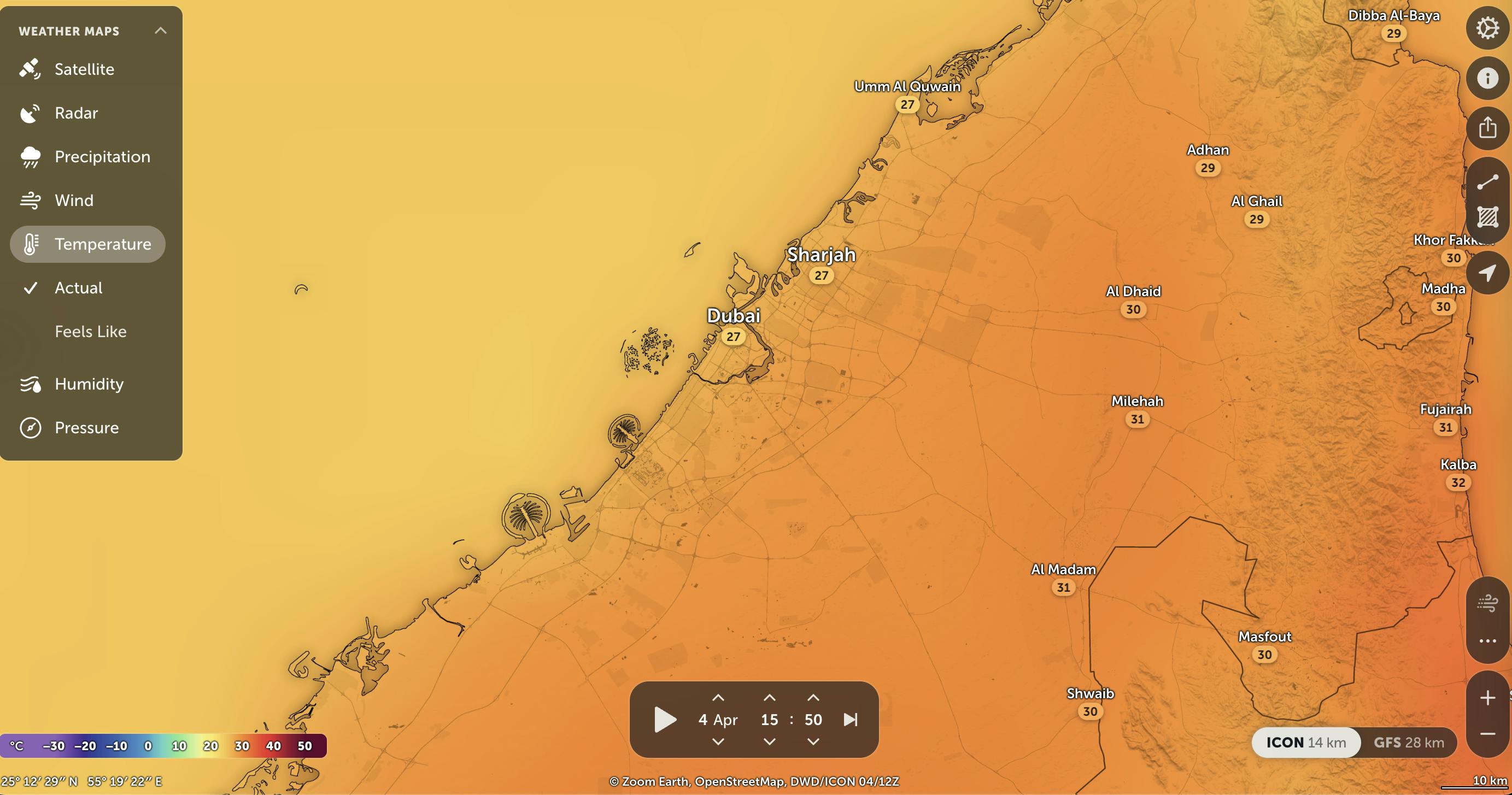
- Live Weather Map & Hurricane Tracker
- Geo Hint
- Resources
Open Source Intelligence (OSINT)
Open Source Intelligence (OSINT) in the context of map intelligence involves leveraging publicly available geographic information to gather insights, assess situations, and make informed decisions. This can include:
Satellite Imagery: Utilizing satellite imagery from platforms like Google Earth, DigitalGlobe, and Sentinel Hub to observe and analyze various geographical features, infrastructure, and activities on the ground. This information can be invaluable for monitoring environmental changes, tracking urban development, or assessing the aftermath of natural disasters.
Geotagged Social Media Data: Extracting location-based data from social media platforms such as Twitter, Instagram, and Facebook to understand trends, events, and public sentiment in specific geographical areas. Geotagged posts and photos can provide real-time updates on happenings like protests, emergencies, or cultural events.
OpenStreetMap (OSM) Leveraging crowd-sourced mapping data from platforms like OpenStreetMap to access detailed information about roads, landmarks, points of interest, and infrastructure. OSM data can be enriched with additional layers such as transportation networks, land use, and demographic information to support spatial analysis and planning.
Publicly Available GIS Data: Accessing publicly available geographic information system (GIS) datasets from government agencies, research institutions, and non-profit organizations. These datasets may include demographic data, environmental indicators, land cover classifications, and administrative boundaries, which can be used for spatial analysis and decision-making.
Open Source Investigation (osinv)
Open Source Investigation (OSI) in the realm of map investigation involves systematically gathering, analyzing, and verifying geospatial information from publicly available sources to uncover facts, identify patterns, and support decision-making. This can include:
Location-Based Analysis: Using geospatial analysis techniques to investigate specific locations or areas of interest. This may involve overlaying multiple layers of geospatial data (e.g., satellite imagery, land use maps, transportation networks) to identify potential anomalies, trends, or patterns.
Spatial Temporal Analysis: Analyzing changes in geographic features or activities over time. This could involve comparing historical satellite imagery, monitoring the progression of urban sprawl, or tracking the movement of vehicles or vessels using GPS data.
Event Mapping: Mapping out events, incidents, or phenomena based on geospatial data. This could include mapping the spread of infectious diseases, documenting the locations of criminal activities, or visualizing the impact of natural disasters on affected areas.
Network Analysis: Examining spatial relationships and connections between different entities or locations. This could involve analyzing transportation networks, social networks, or supply chains to uncover hidden relationships or identify potential vulnerabilities.
By combining open source intelligence with map intelligence and investigation techniques, analysts and investigators can gain valuable insights into a wide range of spatial phenomena, from environmental changes and urban development to security threats and geopolitical dynamics. These insights can inform decision-making processes, support strategic planning, and facilitate effective responses to complex challenges in diverse domains.
find the distance between two places
defined polyline on a map
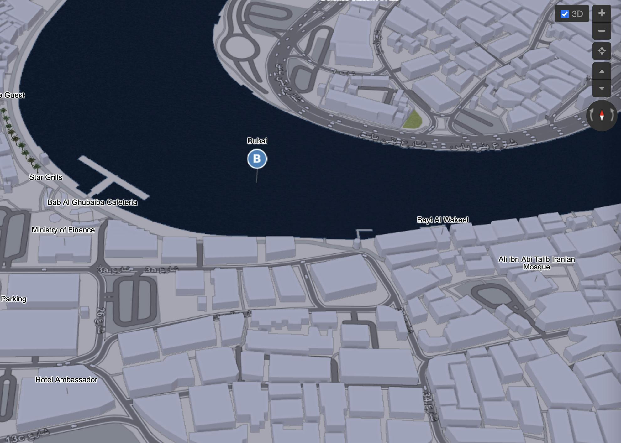
state-of-the-art 3D maps and mountain
Map Compare shows you different maps

Get Json of Specific Location
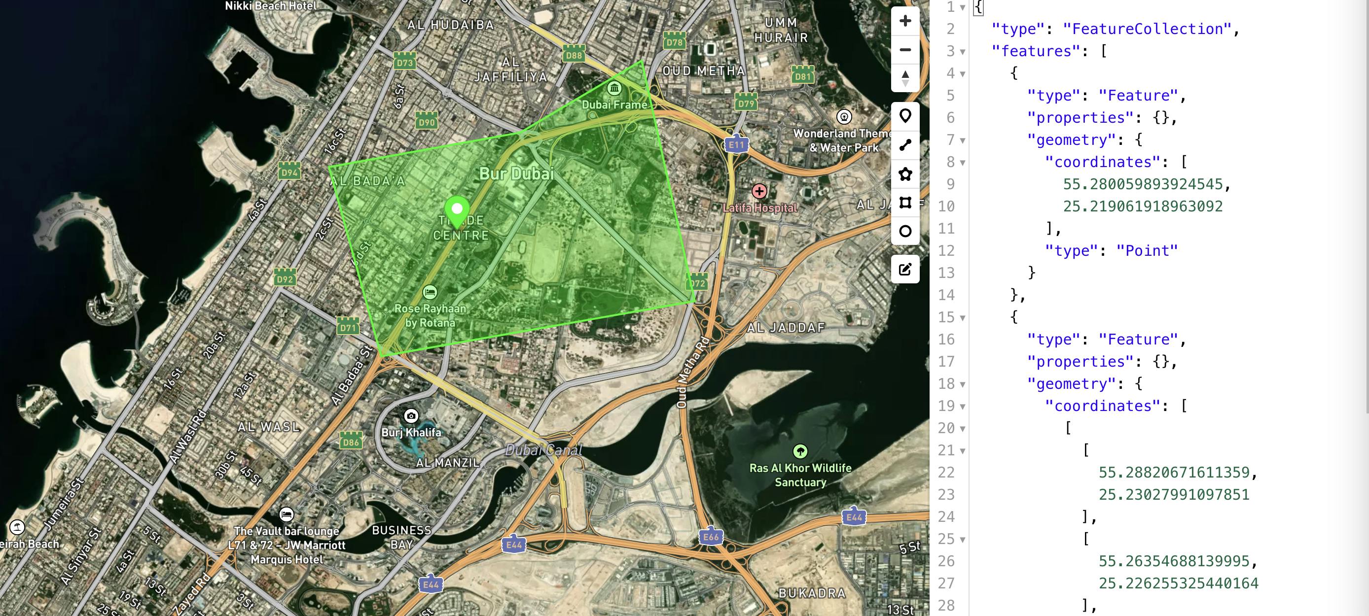
https://geojson.io/#map=15.61/35.69014/51.393933/36/13
The world's maps and images
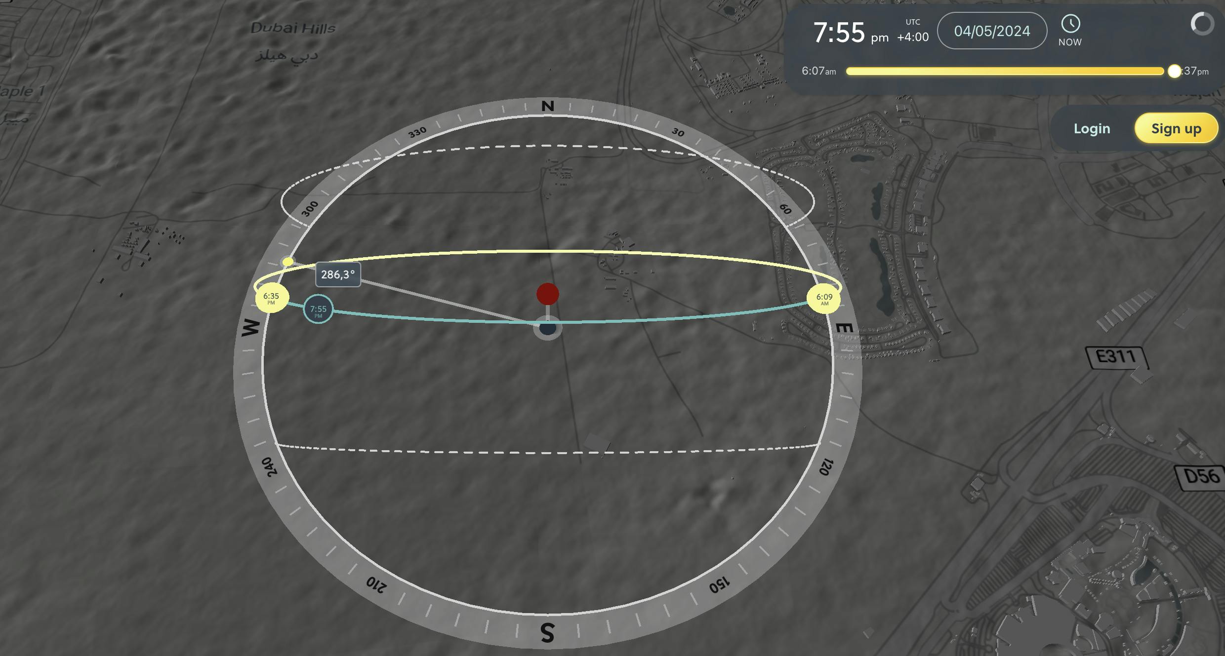
Computation path of the moon
Urban Vehicle Access Regulations by Map
Wind Directions
Daily maps of GPS interference
Query Map
EO Browser
ESRI | World Imagery Wayback
Interactive Map Solutions
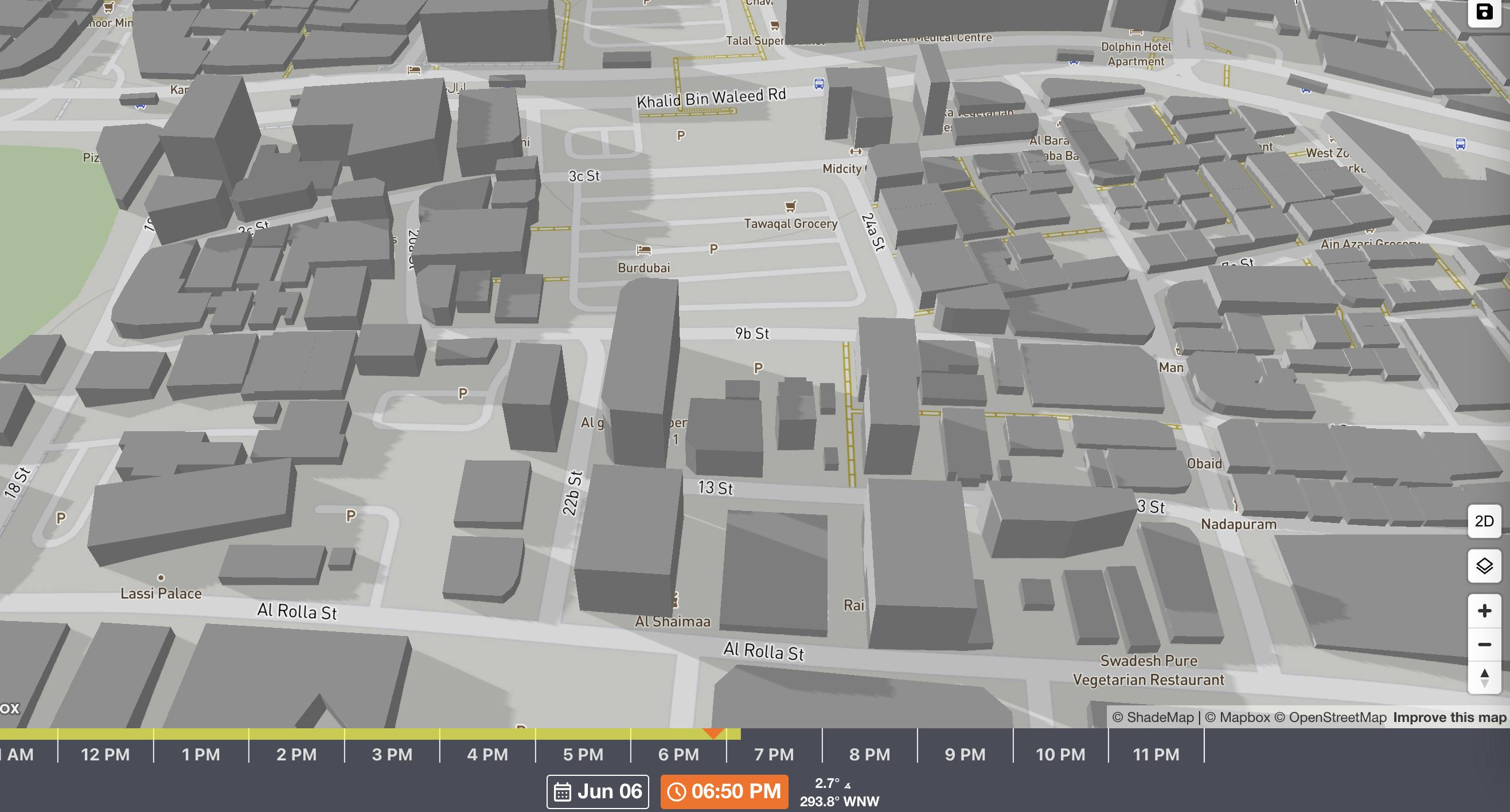
Simulate sun shadows for any time and place on Earth
Live Weather Map & Hurricane Tracker
Geo Hint
Resources
https://www.freemaptools.com/https://peakvisor.com/https://mc.bbbike.org/mc/https://geojson.io/#map=15.61/35.69014/51.393933/36/13https://www.calcmaps.com/https://soar.earth/https://demo.os-surveillance.io/oss/map/100194707456https://osr4rightstools.org/fire-maphttps://urbanaccessregulations.eu/userhome/maphttps://www.mooncalc.org/https://mapsm.com/?t=satellite-streets-v11https://gpsjam.org/?lat=33.76715&lon=50.47420&z=4.3&date=2023-02-12https://overpass-turbo.eu/https://picarta.ai/https://labs.tib.eu/geoestimation/https://huggingface.co/spaces/ydshieh/Kosmos-2https://apps.sentinel-hub.com/eo-browser/https://zoom.earth/maps/satellite/#view=37.6,-93,3.64zhttps://app.shadowmap.org/https://osm-search.bellingcat.com/https://shademap.app/@35.72145,51.33473,17.74332z,1686059584492t,0b,0p,0m,qdGVocmFu!35.72186!51.3347https://demo.f4map.com/#lat=35.7072293&lon=51.3891499&zoom=18https://wikimapia.org/https://livingatlas.arcgis.com/wayback/#active=46399&ext=51.41201,35.68596,51.42323,35.69261https://satellites.pro/Iran_map#35.649856,51.397747,18 qgis: https://docs.qgis.org/3.28/en/docs/user_manual/preamble/foreword.html what distance is suitable best earth for attack satelight: https://geoxc-apps.bd.esri.com/space/satellite-explorer/#norad=45462https://www.mapchannels.com/DualMaps.aspxhttps://syria.liveuamap.com/https://discover.maxar.com/https://googlelens.imagesniper.eu/https://vaness.nl/https://geohints.com/https://www.timeanddate.com/weather/iran/tehran/exthttps://chromewebstore.google.com/detail/openswitchmaps/cfkddjlocfecchnemnnmmpdjcohgmkij